We tend to think of Google Maps as a straight-up navigation tool, like a digital compass that gets us from point A to point B without getting hopelessly lost. But no, there’s more you can use it for.
Discovering Local Businesses
A few months ago, I was craving a good cup of coffee, not the generic stuff from a chain but something with a little more… character. So, I opened up Google Maps, typed in “coffee near me,” and suddenly, I found this charming little spot tucked away on a side street that I would’ve never stumbled upon otherwise. Not only did it serve incredible coffee, but I also learned they host live music on weekends.
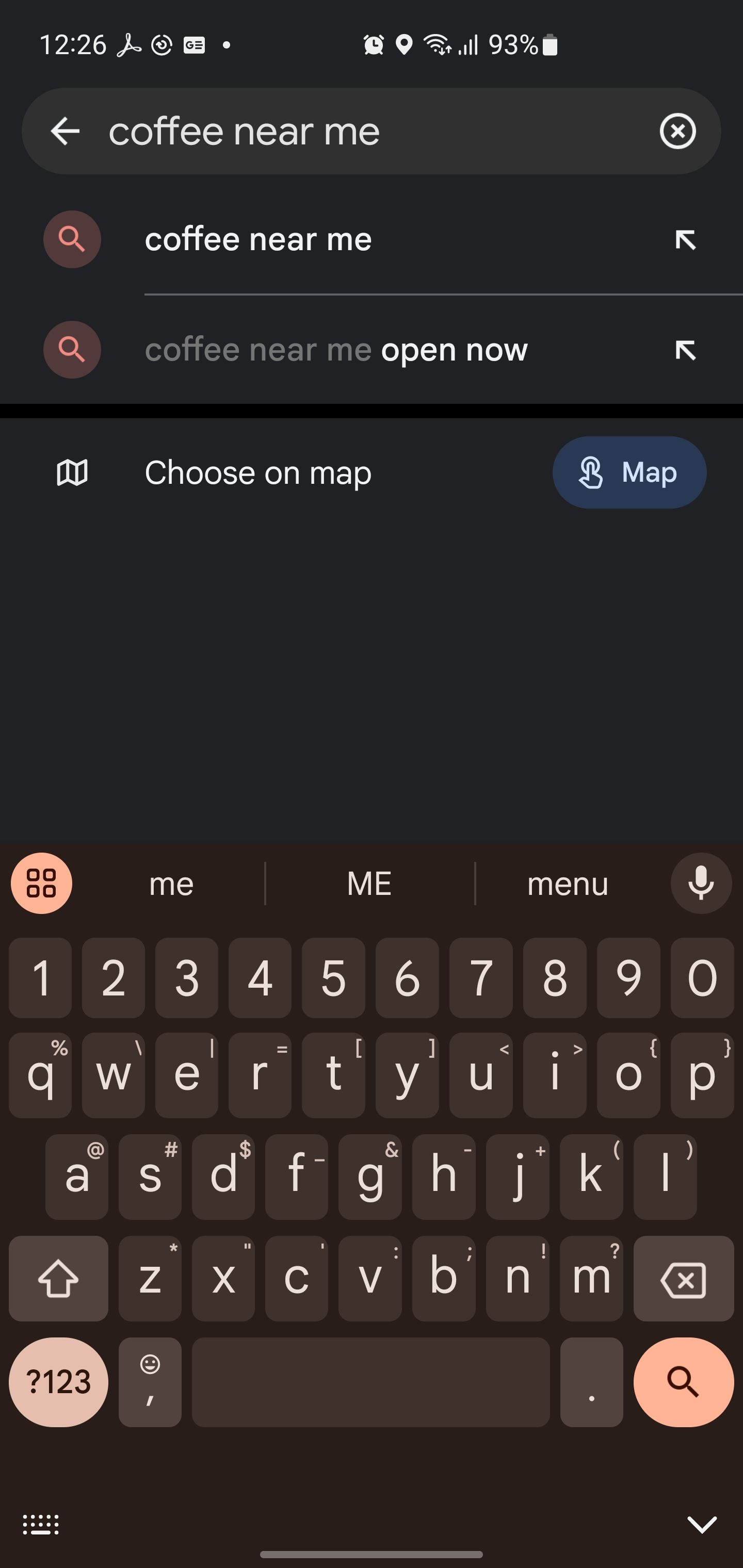
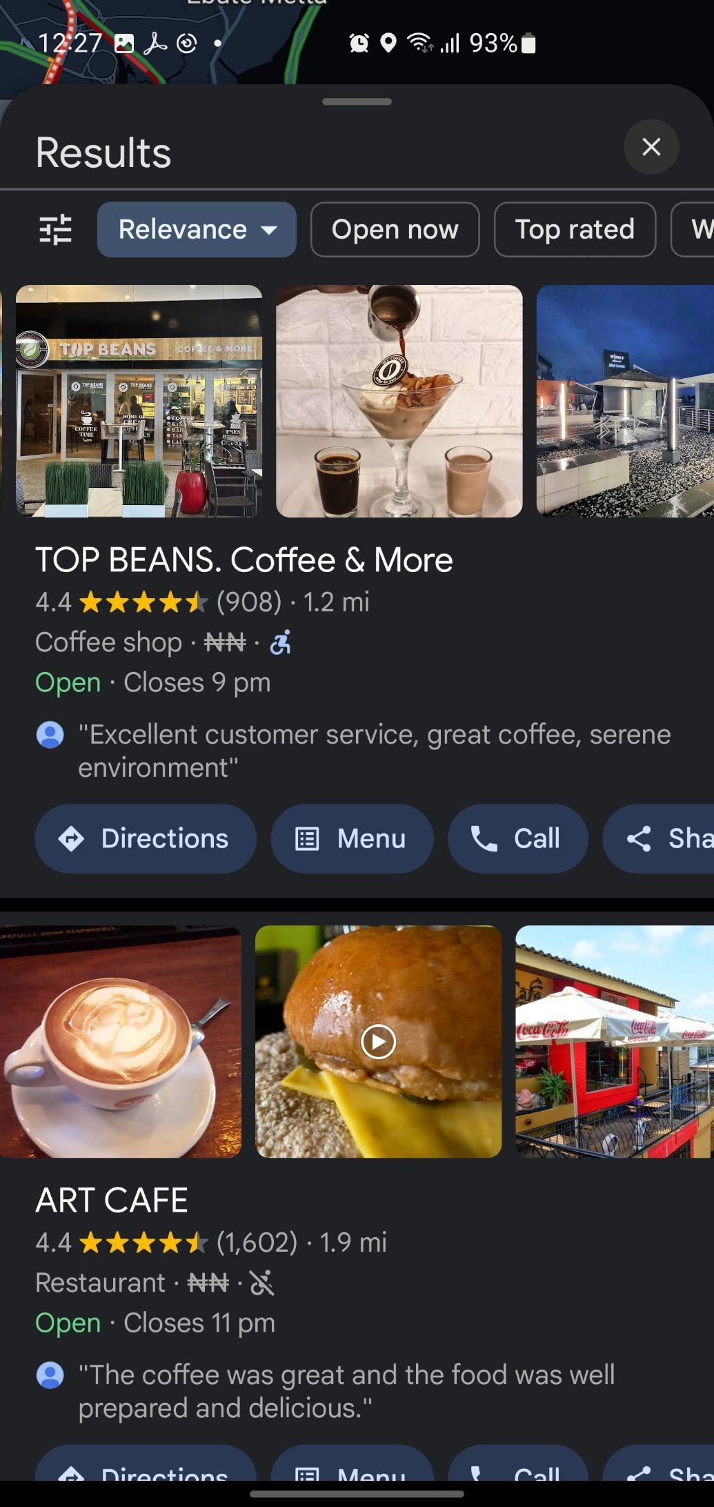
And it’s not just for coffee lovers like me. Whether you’re searching for a new restaurant, a local bookstore, or even a quirky boutique, Google Maps can do the heavy lifting. The app provides detailed business profiles, complete with user reviews, photos, and even links to their websites or social media. You can browse through these details to get a feel for the place before you even step through the door.
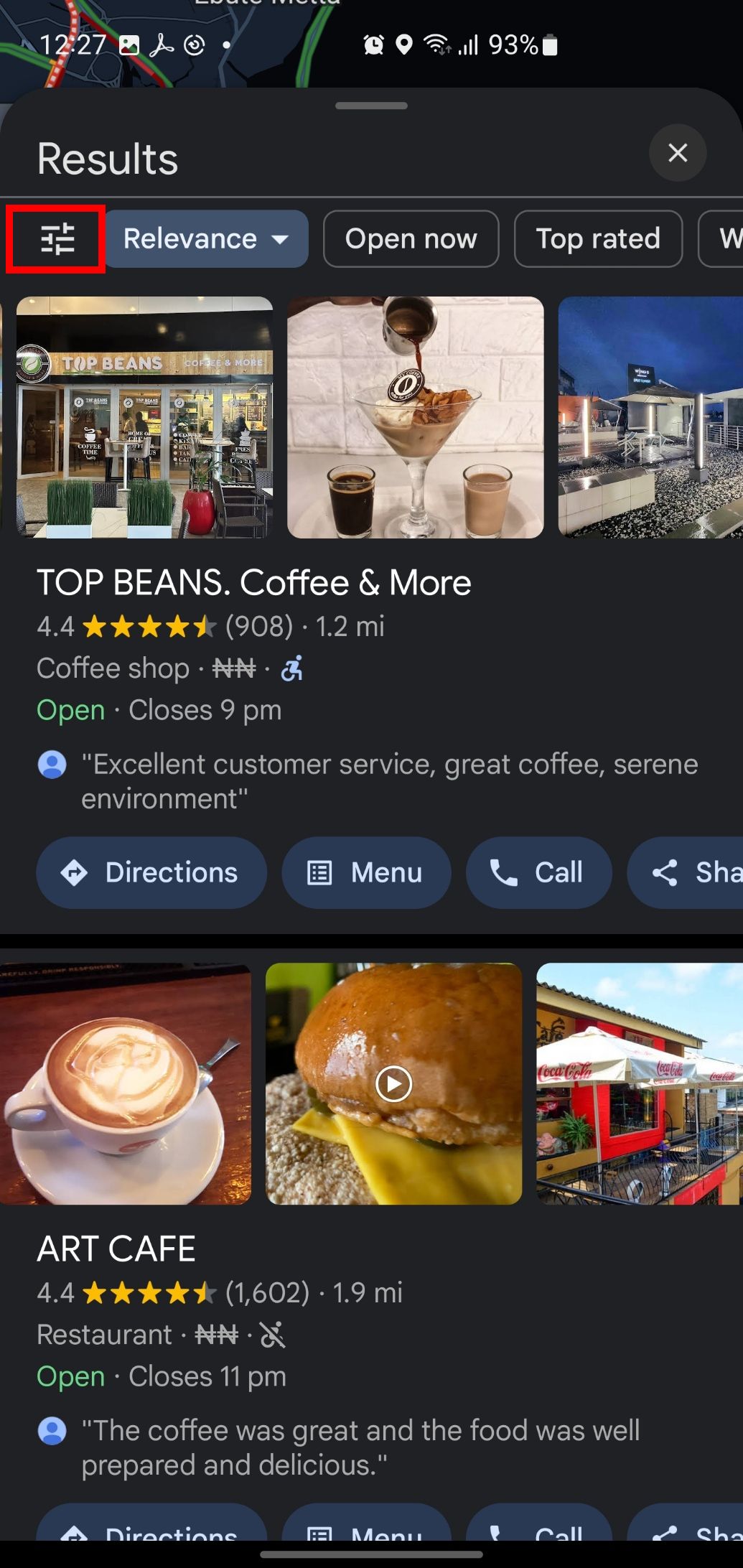
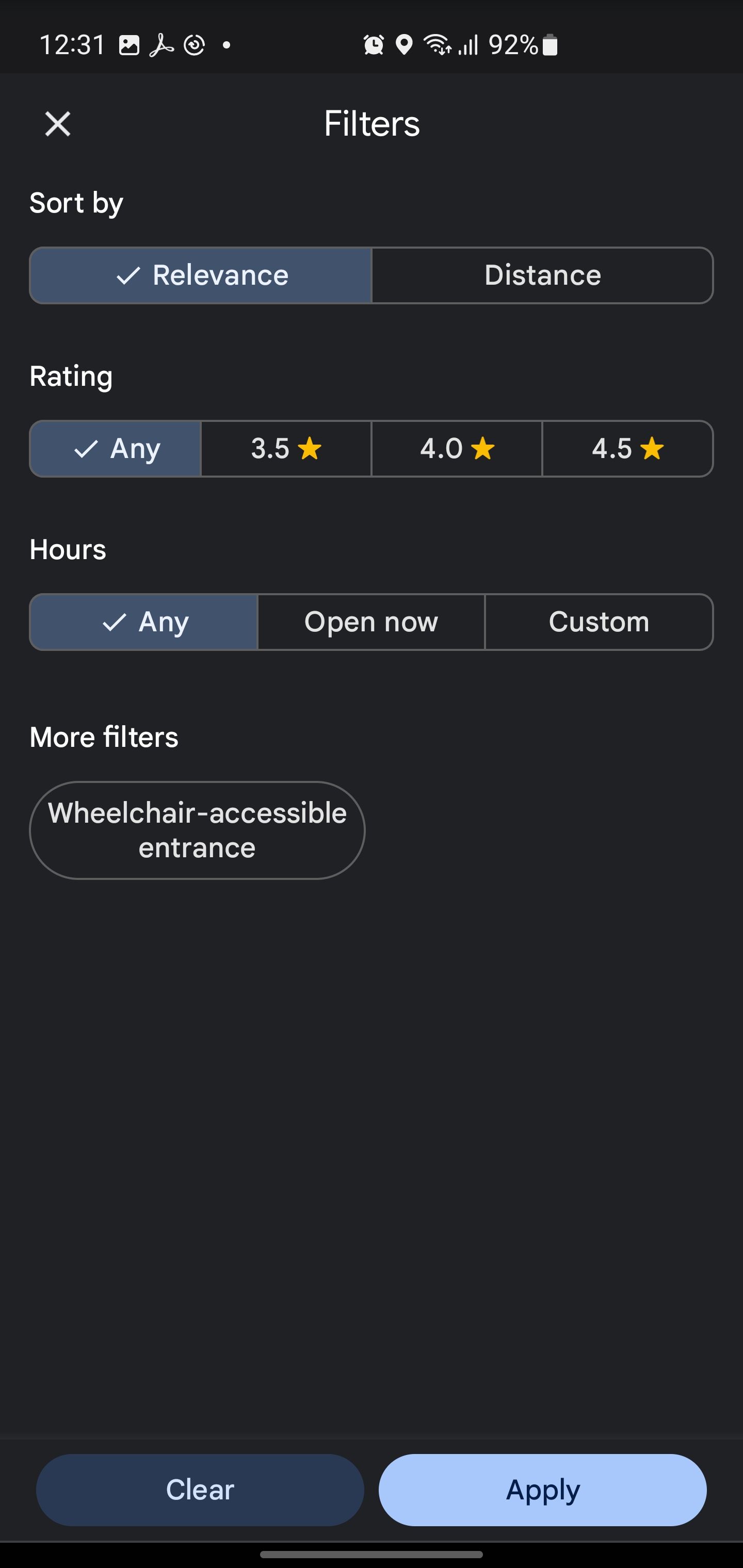
One feature I especially love is the ability to filter by distance, ratings, and opening hours by tapping the filter icon on the search result page. If you’re in the mood for Mexican food, for instance, you can narrow down your search to only show restaurants with four stars or higher.
Trip Planning
Whenever I’m prepping for a trip, I turn to Google Maps to do way more than just figure out how to get from the airport to the hotel. I love starting my trip planning by virtually wandering around the city using Google Maps’ Street View to get a sneak peek of the vibe of different neighborhoods. I’ll zoom in on the area around my hotel, check out nearby restaurants, and see if there are any parks or cool shops within walking distance.
Once I’ve done my virtual walkabout, I use Google Maps’ Saved Places feature to bookmark all the spots I want to visit. You can create different lists—restaurants, museums, hiking trails—and label them however it makes sense for your trip. The great thing is that these lists will sync across devices, so whether I’m on my phone or laptop, all my spots are right there waiting for me.
Trip Recollection
If you’ve ever had one of those “Wait, what did I do last weekend?” moments, then the Google Maps Timeline feature might just be super helpful for jogging your memory. Google Maps uses your location history (assuming you’ve enabled it) to create a detailed timeline of your movements over time. You can go back and look at specific days, months, or even years to see the places you’ve visited, the routes you took, and how you traveled—whether by foot, car, bike, or public transit.
The Timeline also gives you a breakdown of how much time you’ve spent doing different activities, which can be surprisingly eye-opening. Ever wonder just how much time you spend commuting every week? Or how many miles you’ve walked in a month? The Timeline will tell you. It’s a great way to get a sense of your habits and movement patterns. You might even discover some things about yourself. For instance, I was shocked to learn how much time I spend waiting for public transit—seriously, I could write a novel with all that downtime.
One of the features I find particularly handy is the ability to add notes to your Timeline. For example, if you visit a new restaurant and want to remember what you ordered (or avoid ordering next time), you can add a quick note to that day’s timeline entry to jog your memory later.
Sharing Live Location
Google Maps has this “Share Trip Progress” feature where you can temporarily share your navigation and location with friends or family while you’re driving. Once you reach your destination, it automatically stops sharing. I’ve found it useful when I’m late—like really late—and I need to prove that I’m on my way. Sharing my live location has saved me from more than a few passive-aggressive “Are you almost here?” texts. Instead, my friends can just open the app and see where I am.
Beyond that, location sharing adds a layer of safety that’s honestly invaluable. If you’re out late or traveling alone, sharing your location with a trusted friend or family member is a smart way to give them peace of mind. They’ll know where you are, and if something feels off, they can check in with you or even find you if it’s necessary.
Predicting Traffic
Google Maps can help you avoid all the traffic nightmares in between your current location and your destination. The app uses real-time data from drivers on the road, GPS signals, and historical traffic patterns to give you a heads-up on what’s happening out there.
For example, if you’re heading out during rush hour, Google Maps can actually predict how long your drive will take based on traffic trends from past days and current conditions. It’ll even suggest better routes to avoid heavy traffic. I can’t tell you how many times this feature has saved me from sitting in gridlock.
Now, in case you’re thinking: “How accurate can these predictions really be?” Sure, Google Maps might not be able to predict every fender bender or random road closure, but in my experience, it’s surprisingly spot-on. More often than not, when Google Maps says I’ll get somewhere in 20 minutes, I’m pulling into the parking lot almost exactly on time. And that’s why I always check Google Maps before I head out, even if I already know where I’m going.
Correcting Business Information
If you notice a business with incorrect details—like the wrong address, phone number, or hours of operation—you can easily report or correct it. You just tap on the business in Google Maps, scroll down to the “Suggest an edit” option under the Overview tab, and you’re now helping ensure that no one else shows up at 7 pm for a coffee shop that closes at 6. It’s a small thing, but trust me, it makes a big difference when you’re the person relying on that info.
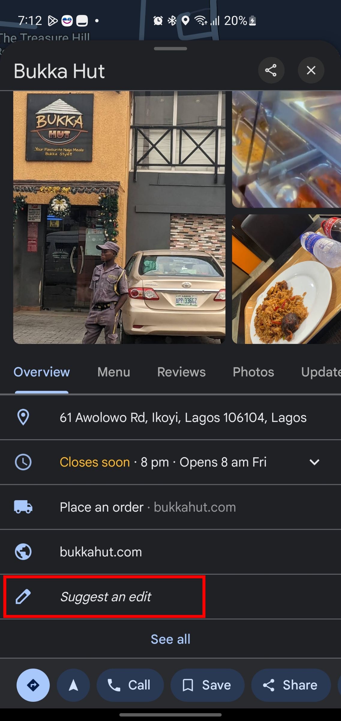
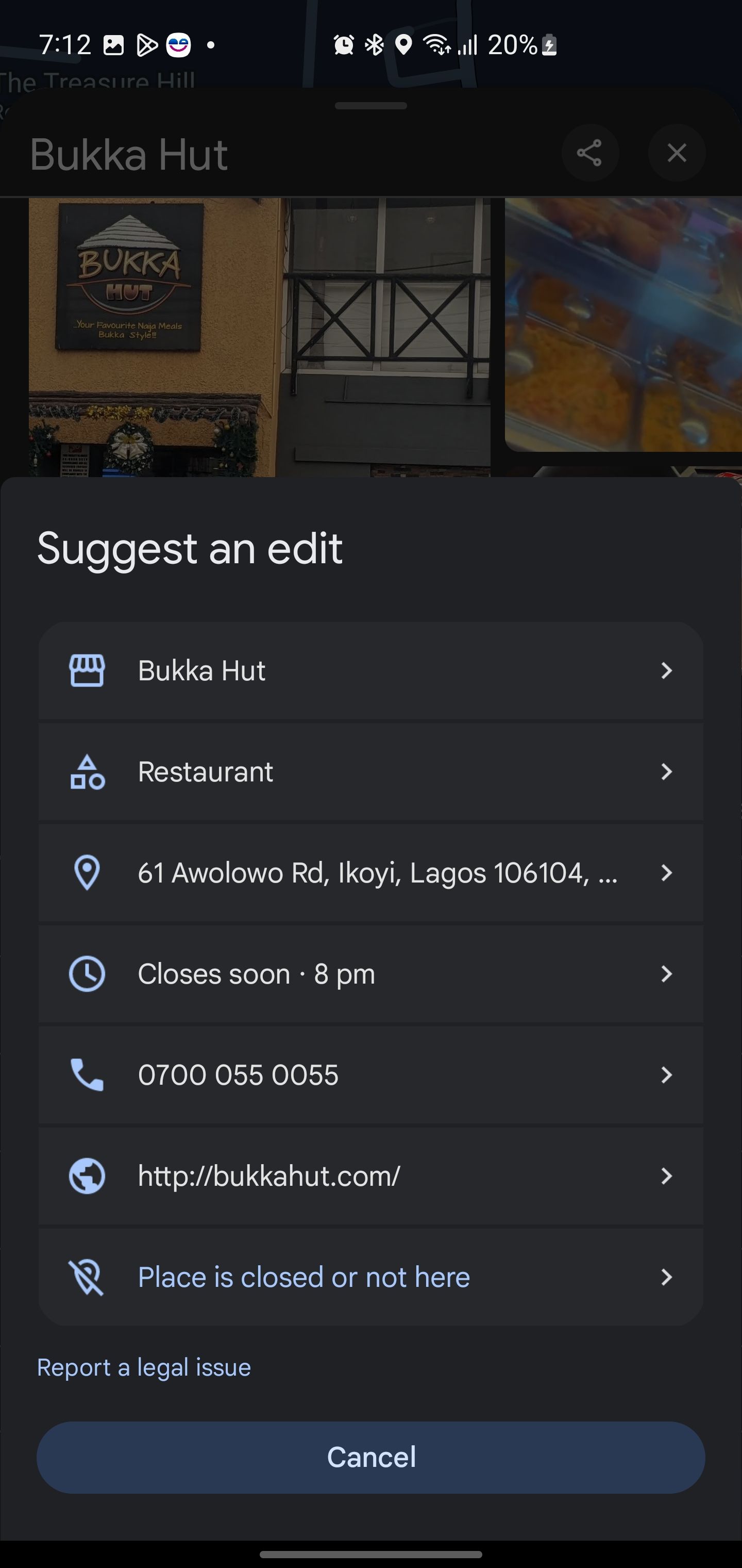
I’ve actually done this myself more than a few times, and it feels oddly satisfying. It feels like I’m tidying up the internet in my own small way. As more people contribute, the map becomes smarter and more accurate for everyone.
Adding New Places
Another way you can contribute is by adding missing or new places. If you’ve visited a new café or a cool pop-up store that Google Maps doesn’t seem to know about yet, instead of waiting for the app to catch up, you can add it yourself. Just drop a pin at the location, select “Add a missing place,” and fill in the details. Everyone else will be able to find that hidden gem you just discovered, and you get to be the hero who put it on the map—literally.
I did this once with a new park in my neighborhood that had yet to show up on the map. It felt pretty amazing knowing that I helped other people find this little slice of nature. And okay, I also felt a tiny bit smug when I saw it pop up on the map a few days later, like, “Yep, that was me.”
Reporting Road Hazards and Real-Time Issues
Have you ever been stuck in traffic because of an accident that wasn’t on the map yet? Or maybe you want to give fellow drivers a heads-up about a sudden road closure? Google Maps lets you report these in real time so other users can avoid the hassle.
This feature is especially helpful when you’re on the road, and something unexpected happens—like a tree suddenly deciding to take a nap across the highway. You simply hit the “Report” button and select the issue (accident, hazard, speed trap, etc.), and your contribution instantly helps others avoid the same fate.
The next time you open up Google Maps, don’t just think of it as a navigation tool—think of all the possibilities you can do with it.


