

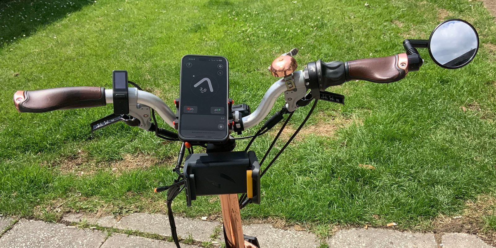
I remember being intrigued the first time I saw the Beeline Velo, with its unusual approach to navigation. Instead of showing you a moving map, it just displays an arrow pointing either directly to your destination, or to your next waypoint on a route.
At the time, I was using a Garmin on my bicycles, but once I switched to mounting my iPhone on my handlebars, that created the question of which app to choose …
There’s no shortage of options here. Both Apple Maps and Google Maps now have reasonably good cycle routes in their database, plus there are plenty of cycling-specific apps, like Ride With GPS.
But I noticed that Beeline could now run as a standalone app, without the need for the Velo hardware, so decided to give it a try. While there is a subscription option, this only offers a couple of extra features which didn’t interest me, so the free version does everything I need.
Four modes
The app offers three different modes for navigation: turn-by-turn directions, as you’d get with any other app; Compass mode (where you make a beeline for the destination); or a hybrid of the two. It also offers a pure logging mode, without navigation.
Turn-by-turn directions
Turn-by-turn directions are obviously great if you’re in a hurry – so want the fastest route – or you want to ensure that you follow a cycle-friendly route.
You can choose between three options here:
Fast will take you on main roads; quiet sticks to segregated cycle routes and back roads; balanced keeps you off the busiest roads, but is more direct than quiet.
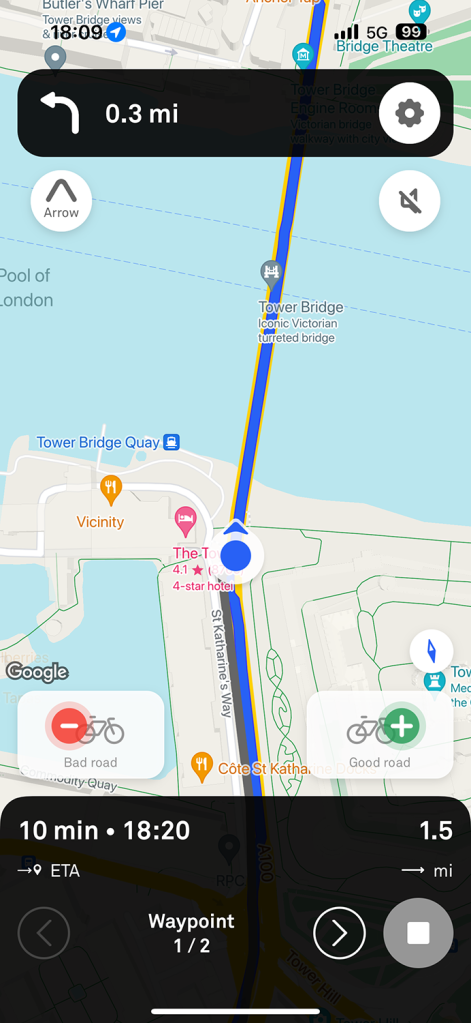
Whichever option you choose, the display is much like Apple Maps or Google Maps: A blue line overlayed on a moving map, with the next turn appearing at the top of the screen. The bottom of the screen displays the estimated riding time, ETA, and distance to go.
It allows multiple waypoints to be included (looking at you, Apple Maps cycle routing), and intelligently puts them into the most sensible order (looking at you, Google Maps).
Compass/beeline
This is the feature I love most about the app, whether I’m cycling around my home city of London, or exploring an unfamiliar one.
With this, the app simply draws a straight line between your starting point and your destination. While you can overlay this on a map, you’d normally combine it with the arrow display. Instead of looking at a map, you’re just looking at an arrow pointing toward your destination. The arc at the top is a curved progress bar.
Within London, I know the city well, so don’t generally need turn-by-turn directions once I know roughly where my destination is, and very much enjoy taking a different route each time. I have a good mental picture of the city as a whole, so know roughly which direction I should be headed at any given point.
However, London’s street layout is nothing like the typical grid layout you get in the US! Roads have curves, forks, U-shapes, you name it. Plus the winding path of the River Thames means that what you might mentally picture as a straight line can easily have a 90-degree curve over its length.
That means that although my mental maps will always get me to my destination, I may be taking a less direct route than I think – especially when the shortest route involves crossing the river twice, which is an unintuitive thing to do.
But with an arrow pointing directly to my destination, I can make more efficient route choices even in meandering mode. Even better, by trying to follow the arrow as directly as possible, I get to explore routes I’ve never cycled even on journeys where I thought I’d pretty much explored all the possible variations.
This is also the mode I most love when exploring an unfamiliar city. I specifically don’t want turn-by-turn directions, but rather the freedom to cycle on what appear to be the most interesting roads. But if I do have a particular destination in mind, then it’s the perfect balance between not getting lost and still being able to pick my route visually.
Hybrid mode

Technically, there are only the two navigation modes above, and then for each you can choose to display either a moving map or the arrow. But if you select turn-by-turn directions, and choose to display the arrow, I personally think of that as a third mode.
In this setup, the arrow isn’t pointing to your destination, but to the next turn. A dot indicator (here on the right) shows the direction you’ll take when you reach the junction – so in the photo above, I have 0.1 miles to go before a junction where I’ll need to turn right.
You’re still getting all the benefits of the app telling you exactly which turns to take for the fastest or quietest route, but you get less visual clutter. Instead of looking at a map, you just look at an arrow pointing to the next junction, with a distance marker telling you how far to go ’til the next turn, and the dot helping ensure you’re positioned correctly on the approach.
For me, this is ideal for city cycling when you do need to be somewhere on time. It’s easy to see at-a-glance where you need to go, without risking a taxi pulling out in front of you in the time it takes to look at a moving map.
Record mode
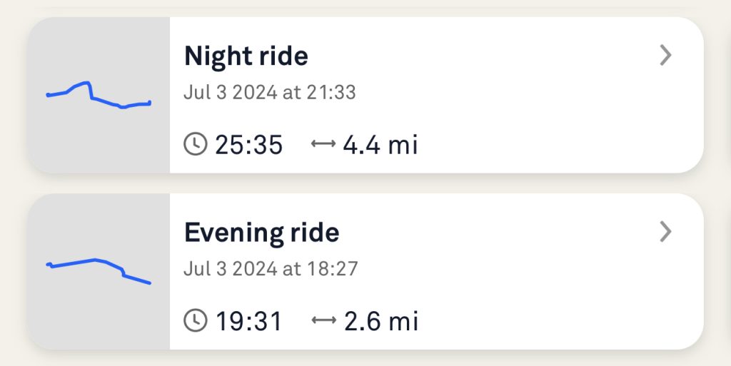
Finally, there’s a pure ‘record’ mode, where you either don’t have a destination in mind, or are cycling a familiar route where no navigation is needed.
Just tap the Record button, and it will display a moving map and also log the ride. In the above example, you can see that I took a direct route for the outbound ride — when I needed to arrive on time — but a more enjoyable indirect one on the way home.
Routing is almost perfect
Both Apple Maps and Google Maps have very variable-quality cycle routes. They are getting better all the time, but often ignore cut-throughs available to cyclists, especially in London where there are a lot of one-way routes with a contra-flow cycle lane. They also sometimes take you on very busy roads which I don’t mind but which are definitely not advisable for less confident urban cyclists.
Beeline, in contrast, offers almost perfect routing in each of Fast, Balanced, and Direct. It does occasionally miss a cut-through, but does much better at these than either Apple Maps or Google Maps. Quiet mode has never taken me onto any road I’d consider dangerous for less confident cyclists.
Additional free features
You can of course save destinations, as with any mapping app, but can also save routes. This is most useful when you want to share a particular route with a friend – you can export it in GPX format, send it to them, and they can import it.
This ability to import complete routes is also useful when participating in organized rides. Organizers often share the route in several different formats, and as GPX is the lowest common denominator for different GPS devices and apps, it’s almost always available.
You get logs of all your rides, and can convert any of these to a route. So if you like a particular route you cycled, even if you weren’t using any navigation features at the time, you can save it in order to follow it another time. You can also export these as GPX, exactly as you would a saved route.
Beeline gives you daily and monthly totals for your rides, handy if you’ve set mileage goals for yourself.
Finally, it creates a heatmap of your rides, which can give an interesting overview of where you ride most often – particularly to identify parts of a city you haven’t explored.
Beeline Plus subscription features
The company was formed to sell the hardware devices, with the app simply a method of programming your route. But with the app able to substitute for the hardware, it needs a way to monetize that.
Enter the Beeline Plus subscription, at $4.99/month. This offers two additional features:
- Audio directions (through speaker or headphones)
- Round-trip generator
The first does exactly what you’d expect, reading aloud details of your next turn, just as you’d expect from any mapping app.
The second is handy if you’re out cycling for fun, know how far you want to go, but don’t want to come up with your own route. You can just select a distance – say 20 miles, round-trip – and the app will calculate a roughly circular ride for you.
The data it uses to do this is influenced by rider ratings of particular roads. Each time you end a ride, the app will ask you to give it a rating on a 5-point scale – and you also have the option of rating any individual road you are on at the time. So when the app generates a route for you, it will aim to use the roads other riders like, and avoid the ones they don’t.
Personally, I’m not a fan of audio directions on a bicycle, and always switch them off in other apps. The circular route generator might be of occasional interest, but the vast majority of my cycling does have a destination – even if it’s a completely arbitrary one – so it’s definitely not a feature I’d pay for.
For me, then, the app is completely free of charge. I do think the company could reasonably charge a one-off fee for the base app without the premium features, after a 7-day trial to prove its value, but don’t tell them I said that!
Beeline is a free download from the App Store. Most users won’t need the optional subscription of $4.99/month. Photo and screengrabs: Ben Lovejoy.
FTC: We use income earning auto affiliate links. More.